Introduction
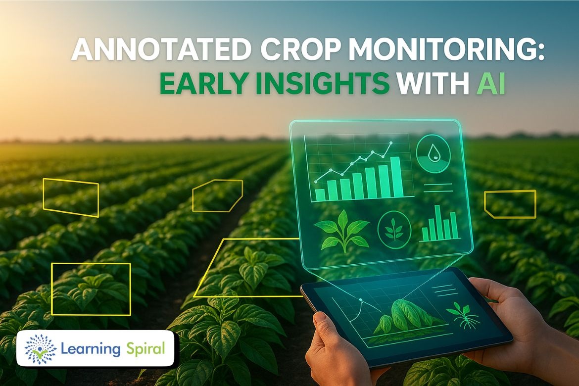
In today’s data-driven agriculture, annotated drone images in crop monitoring are revolutionizing how farmers manage their fields. Drones equipped with high-resolution cameras and sensors capture large-scale aerial imagery of farmland. However, the true potential of this data is realized only through image annotation — the process of labeling features such as crop health, weed growth, soil conditions, and pest infestations.
Why Annotated Drone Images Matter in Precision Farming
By combining drone imagery with AI-powered annotation tools, massive datasets can be systematically labeled to train machine learning models. These models detect patterns, predict risks, and empower farmers with data-driven insights.
Key benefits include:
-
Smarter irrigation and fertilization planning
-
Early pest and disease detection
-
Reduction in resource waste
-
Improved yield and sustainability
Applications of Drone Image Annotation in Agriculture
1. Crop Health Monitoring
Identify nutrient deficiencies and differentiate between healthy and unhealthy plants.
2. Weed and Pest Detection
Bounding boxes and polygons help detect weeds and pest-affected areas with accuracy.
3. Soil and Field Condition Analysis
Semantic segmentation enables classification of soil, water, and vegetation regions to optimize resource use.
4. Plant Counting & Canopy Estimation
Annotation supports plant population analysis and canopy coverage measurement to maximize field productivity.
5. Predictive Farm Management
AI-driven annotations improve yield forecasting and reduce risks with real-time decision support.
Learning Spiral AI: Driving Smart Farming with Data Annotation
At Learning Spiral AI, we help agritech companies and farmers harness the power of annotated drone images. Our expert-led data annotation services ensure accuracy, scalability, and confidentiality, enabling smarter agricultural solutions.
Our Key Services Include:
-
Drone Image Annotation – Pixel-perfect labeling for crop health, pest zones, and land segmentation.
-
Bounding Boxes & Polygon Annotation – Detect weeds, crop rows, and affected areas precisely.
-
Semantic Segmentation – Differentiate soil, vegetation, and water for predictive models.
-
Object Detection & Classification – Classify crop types and identify threats automatically.
-
QA & Validation – Rigorous checks for consistent, error-free annotation datasets.
With our expert annotation workflows, farmers and agribusinesses can maximize yield while reducing costs — making agriculture more sustainable, efficient, and profitable.
Conclusion
Annotated drone images in crop monitoring are shaping the future of precision farming. By leveraging AI-driven annotations, farmers gain actionable insights that improve yield, cut costs, and ensure long-term sustainability. Partner with Learning Spiral AI to unlock the full potential of drone-based crop monitoring.