
What This Article Covers
- What aerial image annotation means
- Why defense and surveillance AI needs high-quality labeled data
- Common annotation types used in aerial imagery
- Practical use cases across surveillance, infrastructure, and security
- A decision framework for choosing the right annotation method
- Quality control steps for reliable AI training data
- Common mistakes to avoid
- FAQs about aerial image annotation
What Is Aerial Image Annotation?
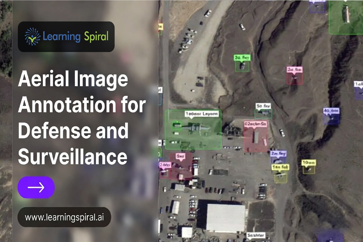
Aerial image annotation is the process of labeling objects, regions, terrain features, and movement patterns in drone, satellite, or aircraft imagery so AI models can understand overhead visual data. It helps computer vision systems detect vehicles, roads, buildings, boundaries, infrastructure, and changes in complex real-world environments. Learning Spiral AI’s aerial imagery solutions focus on annotated drone and aerial data for feature detection, landscape monitoring, and decision support.
Why Aerial Image Annotation Matters in Defense and Surveillance AI
Modern defense and surveillance systems rely heavily on visual intelligence. Drones, satellites, fixed cameras, and aerial mapping platforms can generate large volumes of imagery, but the real challenge is not only collecting that data. The challenge is making it usable for machine learning.
Aerial imagery is different from normal ground-level images. Objects appear from a top-down angle. Vehicles may look small. Shadows, weather, terrain, altitude, camera angle, and resolution can change the appearance of the same object. Research on aerial object detection highlights that scale variation and object orientation make aerial imagery more difficult than standard natural-image detection tasks.
This is where high-quality data annotation becomes important. A defense or surveillance AI model must learn from correctly labeled examples before it can identify patterns in new imagery. Poor labels can lead to missed detections, false alerts, or unreliable results in sensitive environments.
Public aerial datasets show how large and detailed this work can become. The xView overhead imagery dataset contains over 1 million object instances across 60 classes, with 0.3-meter resolution and coverage across 1,415 square kilometers. It was created to advance computer vision for national security and disaster response applications.
The Role of Training Data in Surveillance Accuracy
A model trained on general image data may recognize a car from a street-level view, but that does not mean it can identify the same vehicle from 400 feet above the ground. Aerial image annotation helps AI models learn:
- Object shape from top-down views
- Vehicle orientation and direction
- Building outlines and infrastructure boundaries
- Road networks and access paths
- Terrain changes over time
- Movement patterns in video feeds
- Small object detection in dense scenes
- Scene classification for high-level monitoring
For defense and surveillance, accuracy depends on how well the training dataset reflects real operating conditions. This includes different geographies, camera resolutions, lighting conditions, seasonal changes, object sizes, and edge cases.
High-quality annotation is not just data—it is the foundation of reliable AI systems.
Common Types of Aerial Image Annotation
Aerial imagery projects may require different annotation methods depending on model goals. A simple detection model may need bounding boxes, while advanced monitoring systems may require segmentation, tracking, or 3D annotation.
1. Bounding Box Annotation
Bounding box annotation uses rectangular boxes to mark objects such as vehicles, buildings, aircraft, ships, equipment, or checkpoints. It is commonly used for object detection models.
Best for:
- Vehicle detection
- Asset identification
- Object counting
- Perimeter surveillance
- Aerial traffic monitoring
Bounding box annotation is useful when the goal is to detect whether an object exists and where it is located in the image.
2. Oriented Bounding Boxes
In aerial imagery, objects rarely appear perfectly horizontal. Vehicles, ships, aircraft, containers, and buildings may appear at different angles. Oriented bounding boxes allow annotators to mark rotated objects more accurately.
Best for:
- Aircraft detection
- Ship monitoring
- Vehicle orientation tracking
- Dense object detection
- Defense-grade overhead imagery analysis
The DOTA aerial image dataset uses oriented annotations because objects in aerial views often vary widely in scale, direction, and shape.
3. Polygon Annotation
Polygon annotation marks object boundaries more precisely than rectangular boxes. It is useful when objects have irregular shapes or when the model must understand exact outlines.
Best for:
- Building footprint detection
- Road boundary mapping
- Fortification or infrastructure outline detection
- Land-use classification
- Complex object boundary labeling
4. Semantic Segmentation
Semantic segmentation labels every pixel according to a class, such as road, building, vegetation, water, vehicle, runway, or restricted zone. This is useful when the model must understand the full scene, not just individual objects.
Best for:
- Terrain classification
- Urban surveillance
- Border area mapping
- Disaster assessment
- Critical infrastructure monitoring
5. Instance Segmentation
Instance segmentation separates each object as an individual instance, even when multiple objects belong to the same category. For example, it can identify each individual vehicle in a parking area.
Best for:
- Object counting
- Crowd or convoy density estimation
- Vehicle clustering analysis
- Equipment-level monitoring
- Dense scene analysis
6. Video Annotation
Surveillance is often video-based, not image-based. Video annotation labels objects frame by frame and tracks their movement across time.
Best for:
- Movement tracking
- Suspicious activity detection
- Vehicle path analysis
- Drone-based surveillance
- Long-duration monitoring
Learning Spiral AI lists video annotation as one of its core data annotation services, including object localization and frame-by-frame tracking use cases.
7. LiDAR and 3D Point Cloud Annotation
Some defense and surveillance projects combine aerial imagery with LiDAR, radar, or 3D point cloud data. LiDAR annotation helps identify objects in 3D space using cuboids, segmentation, and spatial labeling.
Best for:
- Terrain modeling
- Autonomous drone navigation
- 3D infrastructure mapping
- Obstacle detection
- Aerial and ground sensor fusion
Learning Spiral AI’s LiDAR annotation page explains that LiDAR annotation identifies objects in 3D point clouds and uses bounding cuboids to return object positions and sizes.
Practical Use Cases of Aerial Image Annotation in Defense and Surveillance
1. Critical Infrastructure Monitoring
AI models trained on annotated aerial imagery can help monitor airports, ports, rail networks, power plants, bridges, warehouses, and communication assets. The goal is not only to detect objects but also to understand changes over time.
Examples include:
- Detecting unauthorized construction near sensitive zones
- Monitoring road access around infrastructure
- Identifying changes in building patterns
- Tracking parked vehicles or equipment
- Comparing pre-event and post-event imagery
2. Border and Perimeter Surveillance
Aerial image annotation supports models that identify movement, terrain boundaries, road access points, and unusual activity near border or perimeter zones.
Common labels may include:
- Roads
- Fences
- Vehicles
- Footpaths
- Structures
- Watch points
- Water bodies
- Restricted areas
For surveillance AI, accurate labels help reduce false positives and improve situational awareness.
3. Drone-Based Area Monitoring
Drone imagery is useful for real-time and periodic surveillance. Annotated drone data can train models to recognize obstacles, vehicles, people, temporary structures, and area changes.
Learning Spiral AI’s aerial imagery use cases include drone imagery for autonomous flight, safe landing, obstacle recognition, and object detection.
4. Disaster Response and Security Planning
Defense and public safety teams often support disaster response. Aerial annotation helps AI models detect damaged buildings, blocked roads, flooded areas, temporary shelters, and rescue access routes.
The xView challenge was designed around national security and disaster response, and its disaster response theme focused on using overhead imagery to detect natural disasters, assess impact, and support response planning.
5. Maritime and Coastal Surveillance
Aerial and satellite imagery can be used to monitor coastal areas, ports, vessels, and shipping routes. Annotation helps train models to identify ships, docks, containers, restricted zones, and coastal infrastructure.
Useful annotation types include:
- Oriented bounding boxes for ships
- Polygon annotation for docks and shorelines
- Segmentation for water, land, and infrastructure
- Video annotation for vessel movement
6. Urban Security and Smart Surveillance
In urban surveillance, aerial imagery can help analyze road density, building layouts, traffic movement, emergency access routes, and large-area monitoring.
Learning Spiral AI’s aerial imagery page also highlights urban planning with AI, where accurately labeled imagery helps detect houses, buildings, and infrastructure.
Manual vs AI-Assisted Aerial Image Annotation
| Factor | Manual Annotation | AI-Assisted Annotation |
|---|---|---|
| Best For | Complex, sensitive, high-precision datasets | Large-volume datasets with repeatable patterns |
| Accuracy Control | Strong human judgment | Faster but needs human validation |
| Speed | Slower for large datasets | Faster for pre-labeling and repetitive tasks |
| Cost | Higher when volume is large | More efficient after model-assisted setup |
| Edge Cases | Better for unusual scenes | May miss rare or unclear objects |
| Quality Review | Human-led QA | Human-in-the-loop QA required |
| Defense/Surveillance Suitability | Strong for sensitive classes | Useful when combined with strict validation |
A practical approach is usually hybrid: AI-assisted pre-labeling for speed, followed by expert human review for accuracy. For high-stakes surveillance, human-in-the-loop validation is essential.
Decision Framework: Choosing the Right Annotation Method
| AI Model Goal | Recommended Annotation Type | Best Use Case | Quality Check Needed |
| Detect vehicles or objects | Bounding box annotation | Vehicle, aircraft, ship, equipment detection | Box tightness, class accuracy, missed objects |
| Detect rotated objects | Oriented bounding boxes | Aerial vehicle and ship detection | Angle accuracy, object alignment |
| Map exact object boundaries | Polygon annotation | Buildings, roads, infrastructure | Boundary precision, overlap checks |
| Understand full scene | Semantic segmentation | Terrain, roads, vegetation, buildings | Pixel-level class consistency |
| Count individual objects | Instance segmentation | Dense vehicle zones, asset counting | Instance separation accuracy |
| Track movement | Video annotation | Drone surveillance, vehicle movement | Frame continuity, track ID consistency |
| Work with 3D spatial data | 3D point cloud annotation | LiDAR, terrain, autonomous systems | Cuboid fit, depth alignment |
A Practical Aerial Image Annotation Workflow
Step 1: Define the Surveillance Objective
Before annotation begins, define what the AI model must do. A vague objective leads to inconsistent labels.
Ask:
- What objects should the model detect?
- What should it ignore?
- Does the model need object location, boundary, direction, or movement?
- Will the model process images, videos, or 3D data?
- What level of accuracy is required?
Step 2: Build a Clear Annotation Taxonomy
A taxonomy defines all classes and labels. For example:
- Vehicle
- Heavy vehicle
- Aircraft
- Ship
- Building
- Road
- Bridge
- Water body
- Open land
- Restricted zone
- Temporary structure
For defense and surveillance projects, class definitions must be specific. “Vehicle” may be too broad if the model needs to distinguish cars, trucks, armored vehicles, or service vehicles.
Step 3: Create Annotation Guidelines
Annotation guidelines are the rulebook for annotators. They should explain:
- How tight bounding boxes should be
- How to label partially visible objects
- How to handle shadows
- Whether to label occluded objects
- How to treat duplicate objects
- How to mark rotated objects
- How to handle unclear images
- When to escalate uncertain labels
Strong guidelines reduce disagreement and improve data quality.
Step 4: Run a Pilot Annotation Batch
Before labeling thousands of images, start with a small pilot batch. Review:
- Label consistency
- Edge-case handling
- Class confusion
- Annotator questions
- Time per image
- QA failure patterns
This prevents large-scale rework later.
Step 5: Apply Multi-Level Quality Control
Defense and surveillance data needs strict quality checks. Recommended QA layers include:
- Self-review by annotators
- Peer review by trained reviewers
- Random sampling by QA leads
- Edge-case review
- Model-assisted error detection
- Final audit before dataset delivery
Step 6: Measure Dataset Quality
Useful quality metrics include:
- Label accuracy
- Missed object rate
- False label rate
- Intersection over Union
- Class consistency
- Annotation agreement
- Edge-case coverage
- Dataset balance
- Model performance after training
Step 7: Iterate With Model Feedback
After training, model errors should guide the next annotation cycle. If the model misses small vehicles, include more small-object examples. If it confuses roads with runways, refine class definitions and add more examples.
This feedback loop improves dataset quality over time.
Common Mistakes in Aerial Image Annotation
| Mistake | Why It Hurts AI Performance | How to Avoid It |
| Using normal image annotation rules for aerial data | Overhead views have different scale, angle, and object appearance | Create aerial-specific annotation guidelines |
| Ignoring small objects | Surveillance models often need to detect tiny objects | Use zoom tools, tiling, and small-object QA |
| Poor class definitions | Annotators may label similar objects differently | Build a detailed taxonomy with examples |
| Not using oriented boxes | Rotated objects may be poorly represented | Use oriented bounding boxes when direction matters |
| Overlooking shadows | Shadows can be mistaken for objects | Add shadow-handling rules in guidelines |
| Labeling only clear objects | Real-world imagery includes blur, occlusion, and low contrast | Include edge cases in training data |
| Weak QA process | Errors scale quickly across large datasets | Use multi-layer review and audit sampling |
| No model feedback loop | Dataset does not improve after first training cycle | Review model errors and update labels |
What Makes Aerial Annotation Difficult?
Small Object Detection
Objects in aerial imagery often occupy very few pixels. A vehicle may appear as a small rectangle, and a person may be difficult to identify depending on resolution and privacy rules. Small object detection requires careful zooming, tiling, and QA.
Object Orientation
Unlike street-level images, aerial objects appear from multiple directions. Ships, vehicles, and aircraft may be rotated at any angle. Oriented bounding boxes are often better than standard rectangular boxes.
Dense Scenes
Parking lots, ports, military logistics zones, urban areas, and industrial sites may contain many objects close together. Dense scenes increase the chance of missed labels and overlapping boxes.
Environmental Variation
Aerial imagery may change due to:
- Time of day
- Weather
- Shadows
- Seasonal vegetation
- Dust or haze
- Camera altitude
- Sensor resolution
- Motion blur
Security and Data Sensitivity
Defense and surveillance datasets may contain sensitive locations or restricted information. This makes controlled access, secure workflows, and trained teams important.
Learning Spiral AI positions its services around scalable, secure, and in-house trained teams, with experience handling sensitive and large-scale data.
Quality Checklist for Defense and Surveillance Annotation Projects
Before final dataset delivery, review these points:
- Are all object classes clearly defined?
- Are bounding boxes tight and consistent?
- Are rotated objects annotated correctly?
- Are small objects checked at proper zoom levels?
- Are partially visible objects handled consistently?
- Are shadow and occlusion rules followed?
- Is the dataset balanced across environments?
- Are rare but important classes included?
- Are QA errors documented and corrected?
- Is there a secure audit trail for project review?
For AI systems used in sensitive or critical environments, risk management should be part of the lifecycle. NIST’s AI Risk Management Framework is designed to help organizations incorporate trustworthiness into the design, development, use, and evaluation of AI systems.
How Aerial Annotation Supports Broader AI Data Solutions
Aerial image annotation often overlaps with other data labeling & annotation services. For example:
- Image Annotation Services: Vehicle, building, object, and terrain detection
- Video annotation: Movement tracking and frame-by-frame surveillance analysis
- LiDAR Annotation: 3D terrain, obstacle, and infrastructure mapping
- Text annotation: Incident reports, surveillance logs, or metadata extraction
- Audio annotation: Emergency communication, radio logs, or command transcription
- 3D point cloud annotation: Spatial intelligence and autonomous navigation support
This is why organizations often look for a Data Annotation Company or Data Labeling Company that can handle multiple data types under one quality framework.
For teams comparing Computer Vision Companies in India, Data Labeling Companies in India, Image Annotation Companies in India, or an Image Annotation Company for defense-grade workloads, the key is not only capacity. The real differentiator is process maturity, security, annotation accuracy, and domain understanding.
Where Aerial Image Annotation Is Used Beyond Defense
Although this guide focuses on defense and surveillance, the same annotation methods are also used in:
- Image Annotation for aerial mapping
- Image annotation for agriculture
- Image annotation for retail site analytics
- Image annotation for logistics and fleet yards
- Image annotation for autonomous vehicles
- Image annotation for sports and games
- Medical data annotation for aerial emergency response planning
- Smart city and infrastructure monitoring
The underlying requirement is the same: accurate, structured, well-reviewed training data.
Why Partner Expertise Matters
Aerial annotation projects are not just volume-based labeling jobs. They require domain-aware instructions, clear escalation rules, consistent QA, and secure delivery. A reliable AI data solutions partner should be able to support:
- Pilot annotation batches
- Annotation guideline creation
- Taxonomy design
- Large-scale workforce management
- Multi-layer quality checks
- Secure data handling
- Fast iteration after model feedback
- Custom output formats for ML teams
Learning Spiral AI works across data annotation, data labeling, computer vision, NLP, LiDAR annotation, image annotation, video annotation, audio annotation, and text annotation workflows, making it suitable for complex annotation projects that require scale and accuracy.
FAQs About Aerial Image Annotation
1. What is aerial image annotation used for?
Aerial image annotation is used to train AI models to detect, classify, segment, and track objects in drone, satellite, or aircraft imagery. It is commonly used in defense surveillance, disaster response, infrastructure monitoring, agriculture, logistics, urban planning, and autonomous navigation.
2. Why is aerial image annotation important for defense AI?
Defense AI requires accurate overhead visual understanding. Annotated aerial imagery helps models recognize vehicles, buildings, roads, infrastructure, terrain, and movement patterns. Without high-quality labels, AI systems may miss important objects or generate false alerts in sensitive environments.
3. Which annotation type is best for aerial surveillance?
The best annotation type depends on the use case. Bounding boxes are good for object detection, oriented boxes are better for rotated objects, polygons are useful for precise boundaries, segmentation helps with full-scene understanding, and video annotation is ideal for movement tracking.
4. How much does aerial image annotation cost?
The cost depends on image volume, annotation type, object density, complexity, quality requirements, data security needs, and turnaround time. Simple bounding boxes cost less than segmentation, oriented boxes, video tracking, or 3D point cloud annotation. A pilot batch is usually the best way to estimate pricing accurately.
5. Is human review necessary in AI-assisted aerial annotation?
Yes. AI-assisted tools can speed up labeling, but human review is essential for defense and surveillance datasets. Human-in-the-loop validation helps correct missed objects, wrong classes, poor boundaries, and edge cases that automated systems may not handle reliably.
Aerial image annotation is a critical step in building reliable defense and surveillance AI systems. Raw drone and satellite imagery may contain valuable information, but only accurate labeling can turn that information into usable training data.
The most effective projects begin with clear objectives, detailed annotation guidelines, the right annotation method, strong quality control, and continuous improvement through model feedback. Whether the requirement involves bounding box annotation, image labeling, video annotation, LiDAR annotation, 3D point cloud annotation, or large-scale data annotation services, quality must remain the central focus.
Organizations working with experienced AI data solution partners often achieve faster model accuracy, better dataset reliability, and smoother deployment.
To explore scalable aerial image annotation, computer vision, and data labeling & annotation services, connect with Learning Spiral AI for practical AI data solutions.